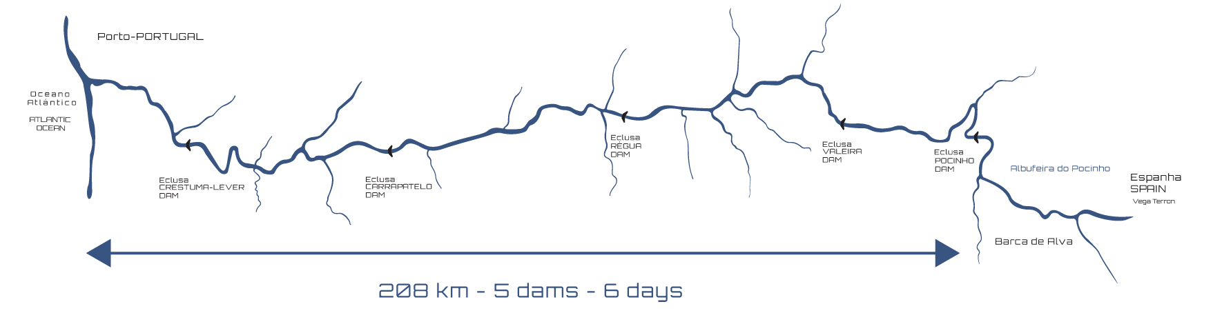
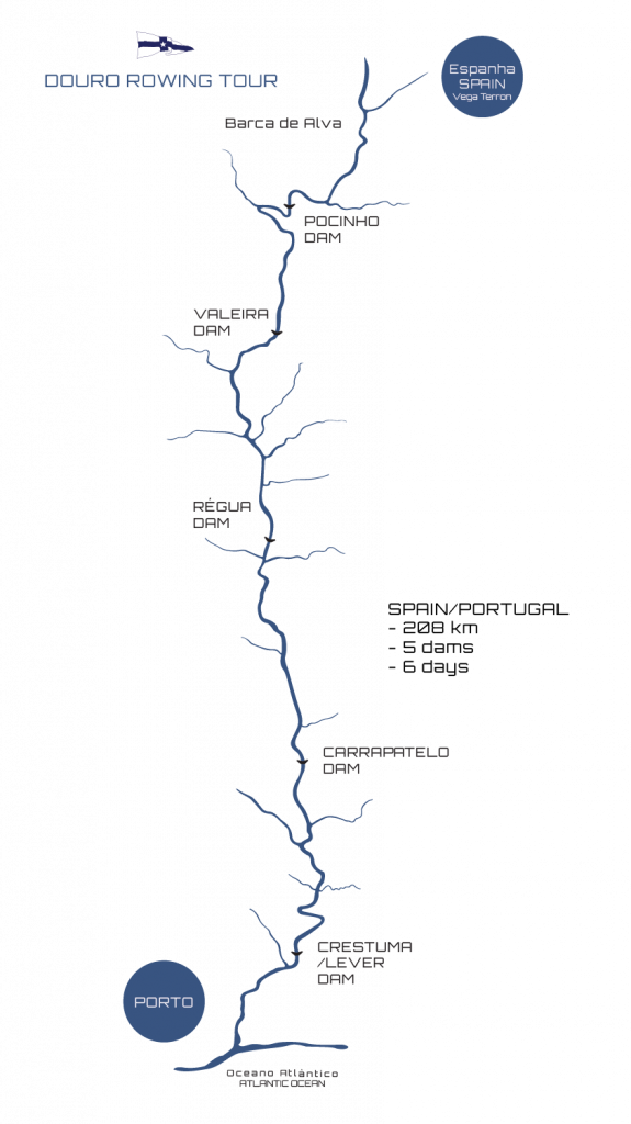
Daily Rowing the Douro River

27.5
km
1 day
Vega Terrón/Barca d’Alva – Pocinho
35.7
km
1 day
pocinho – Valeira
39.8
km
1 day
valeira – Régua
40
km
1 day
Régua – carrapatelo
43.3
km
1 day
carrapatelo – Crestuma
21.7
km
1 day
crestuma – porto
6 days Rowing the Douro River 5 Dams
Vega Terrón/Barca d’Alva – Porto
Water experience: 208KM
- Boat Types: C1, C2 or C4
- Hotel
- Transfers included
- 6 days
Tours/Book now
1.400€
$15
$12

$16
$12

$14
Booking
The Douro River (Spanish: Duero ) is a river that rises in the peaks of the Serra de Urbión , in the Spanish province of Soria, at an altitude of 2160 meters, and crosses the north of Portugal to its mouth near the cities of Porto and Vila. New from Gaia. It is the third longest river in the Iberian Peninsula. It is 897 km long, 572 km on Spanish soil, 213 km navigable in Portuguese territory and 112 km of international character, as its course forms a border. This last section, where the river tightens and its bed deepens, is known as the cliffs. Its banks were protected with the creation of the natural parks of Douro Internacional in Portugal and Arribas do Douro in Spain.
On December 14, 2001, UNESCO included the Alto Douro Wine Region (45°68’N, 5°93’W) in the list of World Heritage Sites, in the category of cultural landscape.
The primordial element, the singular characteristic is unique, either for the magnitude of the escarpments, or for the singularity of the route, or for the majesty of its cannons, or for its centuries-old vineyards, or for the grandeur of the more than 200 km navigable, is the Douro River.
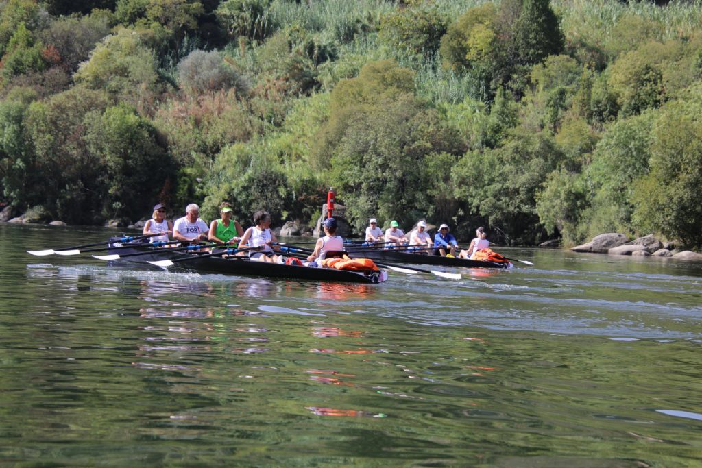
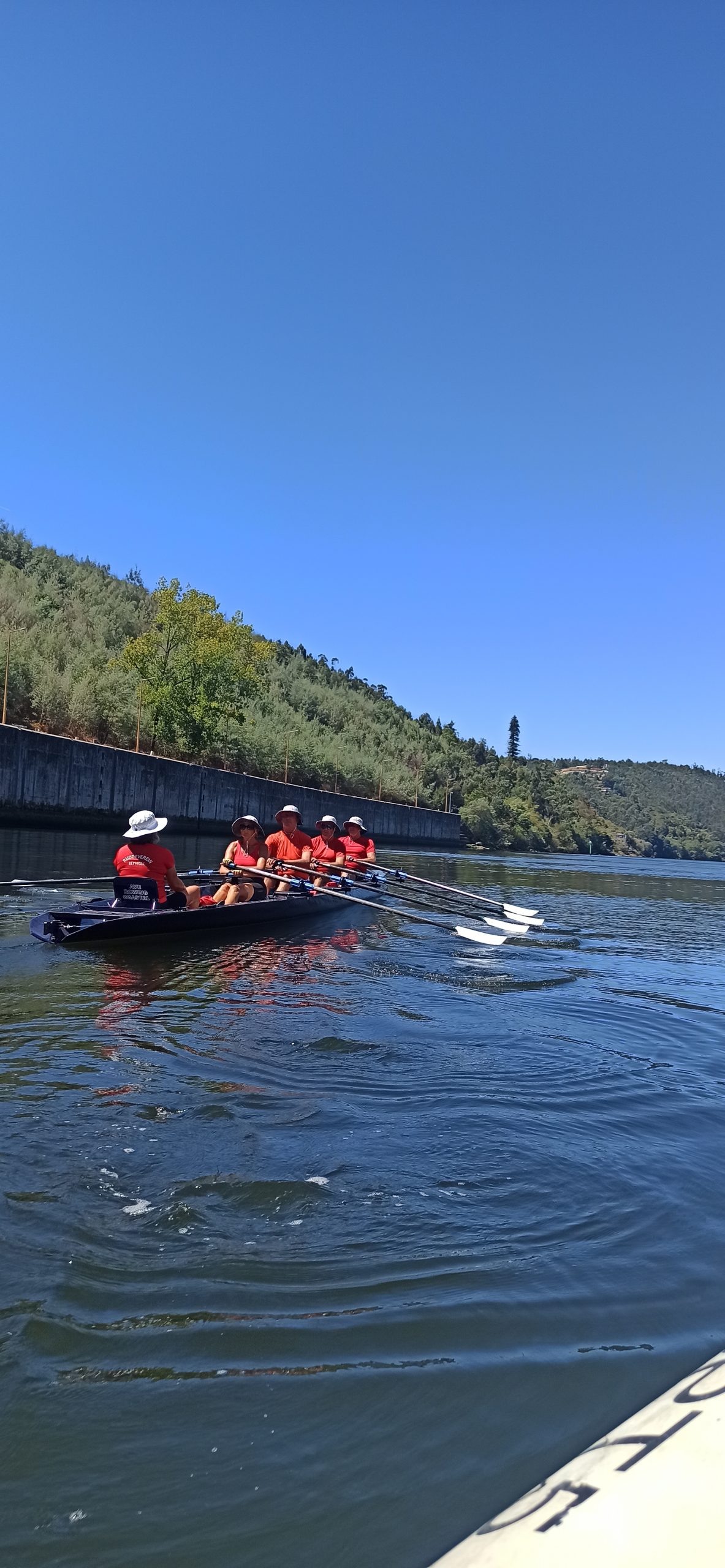
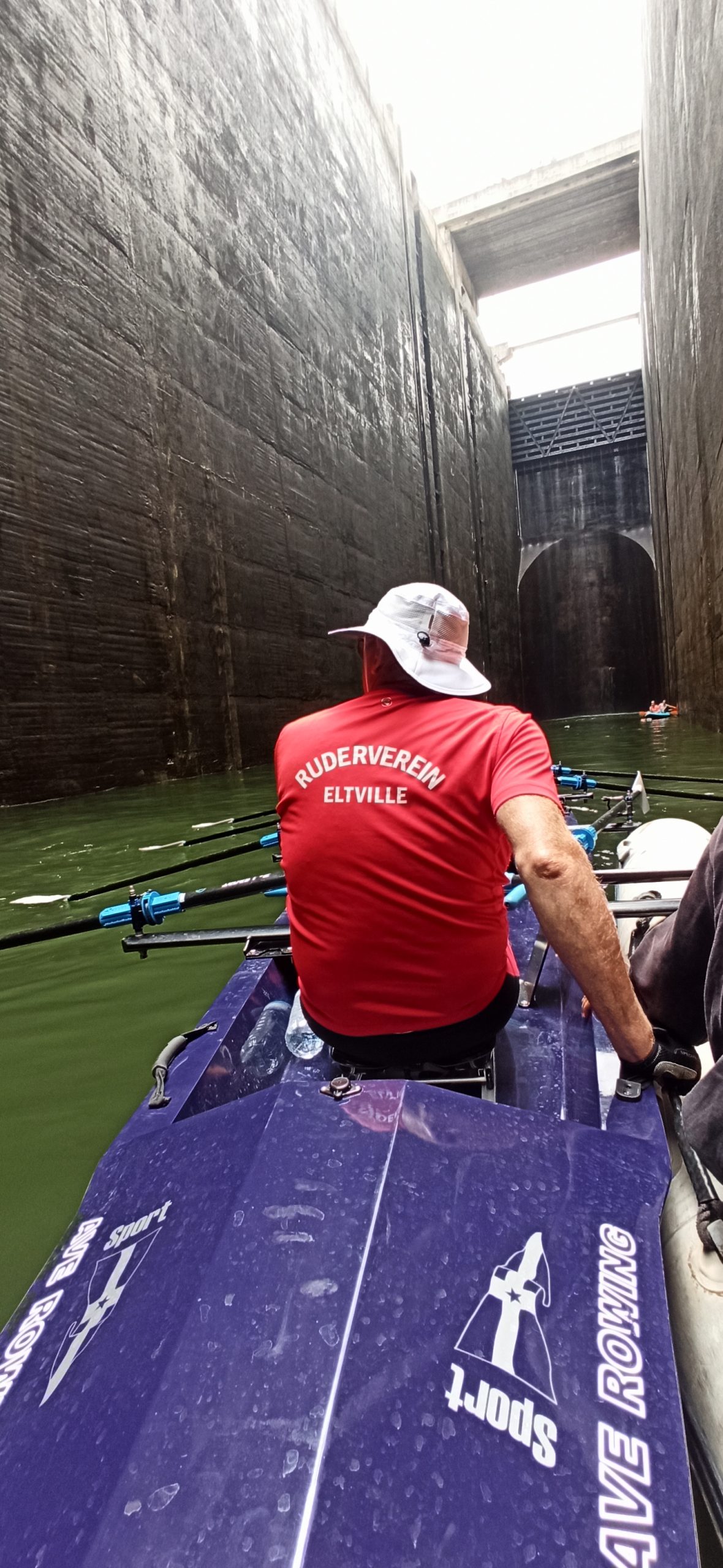
Taking advantage of the high difference in level, especially in the Douro Internacional area, where the average difference in level is 3m/km, from 1961 onwards, the hydroelectric exploitation of the Douro was carried out. With the construction of the dams, thanks to the installation of locks in parallel, large reservoirs of calm waters were created, which came to encourage tourist and recreational navigation, as well as sport fishing, allowing the creation of a navigation channel, where navigation is safe and calm.
testetetetdgxtsgsgdtebdx
ddd